Halfway Point Calculator
Find the halfway point between two cities or addresses by driving time, by driving distance, or on the map, and see towns near the middle.
The halfway point is where two people driving from different places spend the same time behind the wheel. This calculator finds it between two locations, addresses or cities in three ways: by drive time, by road distance and as the straight-line midpoint. It names the town nearest the midpoint and opens it in Google Maps, so you have a real place to meet.
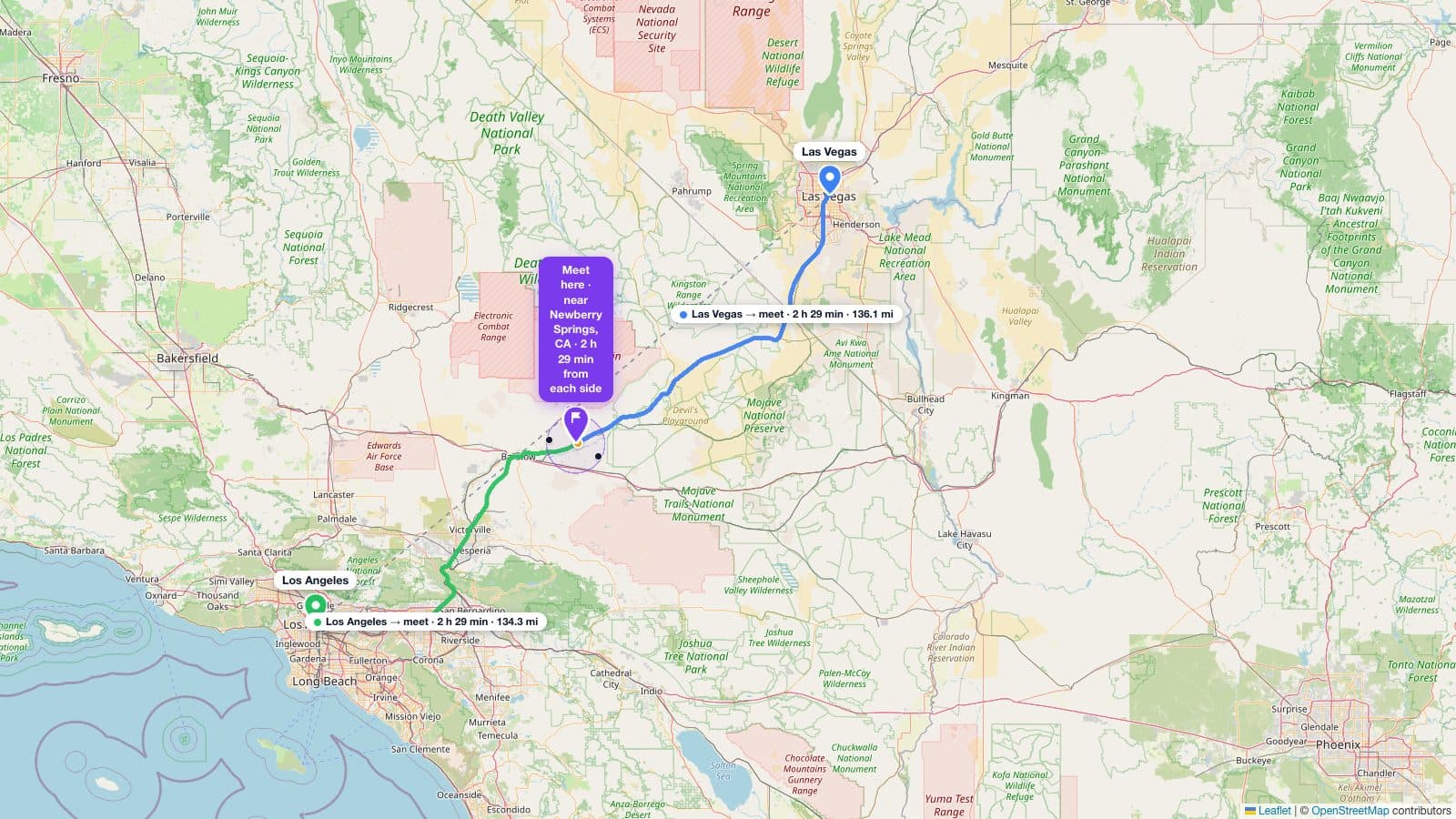
How to find the halfway point between two cities
- Type the first place into Point A (or tap “Use my location”).
- Type the second place into Point B.
- Read the three midpoints on the map and in the results: halfway by driving time, halfway by driving distance, and the straight-line midpoint.
- Pick a town near the middle, then share the link so the other person sees the same map.
Halfway by driving time vs. driving distance vs. the map midpoint
These three points are usually close together, but not identical. The straight-line midpoint is the great-circle midpoint of the two coordinates, and it ignores roads entirely. The halfway-by-distance point sits at 50% of the road route's length. The halfway-by-time point sits where half the estimated drive time has passed.
They diverge when the two halves of the trip move at different speeds: a fast interstate on one side and slow surface streets on the other, or a detour around a bay, mountain, or river. When they differ, halfway by driving time is the fairest: each person spends about the same time driving, which is what most people actually care about when they meet in the middle.
Can Google Maps find the halfway point?
Not on its own. As of October 2026, Google Maps has no built-in halfway or midpoint feature. The usual workarounds are the Measure distance tool or averaging the two sets of coordinates. Both give you the straight-line midpoint, not the drive-time one, so they can land you on the wrong side of a bay or a mountain.
This tool computes the drive-time midpoint and opens it in Google Maps, Apple Maps, or turn-by-turn directions. On an iPhone or Android phone those links open the Maps app directly, so you can go from “where do we meet?” to navigation in a couple of taps.
How the straight-line midpoint is calculated
The straight-line midpoint is the great-circle midpoint: the middle of the shortest path across a round Earth. In plain steps: convert both points to 3-D directions from the Earth's center, average those directions, and convert the result back to a latitude and longitude. It is exact on a sphere, which a flat map is not.
Simply averaging the two latitudes and longitudes is a flat-map shortcut that drifts on long, mostly east–west trips. New York (40.7128, −74.0060) to Los Angeles (34.0522, −118.2437): the true great-circle midpoint is 39.5103, −97.1601 (central Kansas). The averaged point is 37.3825, −96.1249, about 157 miles off and lopsided: 1,206 miles from New York versus 1,259 miles from Los Angeles.
On short trips the shortcut is fine: from Dallas to Houston, the two midpoints differ by about 0.7 miles. All distances here use a spherical Earth with radius 3,958.76 miles.
Meeting halfway between two addresses
The calculator is not limited to cities. Enter two full street addresses and it geocodes each one, then finds the midpoints between them. That helps when you are splitting a commute, a custody handoff, or a first meeting between two exact locations. Every result links out to the coordinates so you can open the spot in your own maps app.
Tips for choosing a meeting spot
- Aim for a named town near the halfway point rather than an empty stretch of road; the tool lists the closest ones.
- Prefer the driving-time midpoint when the two routes have very different speeds.
- Check the time shown for each side; if it looks lopsided, nudge the meeting spot toward the slower side.
- Pick somewhere easy to stop, like a town with parking, food, and a landmark you can name in the share link.
- For a “within X minutes of the middle” view, pair this with the drive time map.
How it works and sources
- Drive times and routes come from OpenStreetMap road data via the OSRM routing engine, at typical speeds with no live traffic.
- Towns near the midpoint come from 2020 Census places (the U.S. Census Bureau Gazetteer), so they are real incorporated places and CDPs, not post-office ZIP names.
- Geocoding (turning a place or address into a point) uses Nominatim, built on OpenStreetMap.
Limits: no live traffic, no ferry waits, and no border-crossing waits. Routes can also differ by direction, so swapping Point A and Point B can move the driving midpoint a little. When we checked in November 2026, swapping Chicago and Indianapolis moved it about 0.2 miles.